
Location
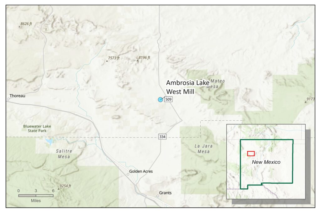
The Ambrosia Lake West mill site is located in the Ambrosia Lake uranium district of New Mexico. The site is located approximately 25 miles north of Grants, New Mexico.
Ownership and History
The Kermac Nuclear Fuels Corporation built the ALW mill site in 1957. It originally consisted of the mill site, uranium mill tailings ponds, and associated outlying evaporation ponds. The mill processed more than 3 million tons of uranium ore between 1958 and 1963. Uranium ore processed at this mill was mined at Sections 17, 22, 24, 30, 30W, 33, 35, and 26 mine sites, which were also owned and operated by the Kermac Nuclear Fuels Corporation. The two unlined tailings impoundments contain 33 million tons of uranium ore byproduct material and construction debris and cover approximately 370 acres. Rio Algom Mining, LLC (RAML) acquired the site in 2001 and remains the responsible party for the site. The primary regulating agencies for the site are the U.S. Nuclear Regulatory Commission (NRC) and New Mexico Environment Department (NMED). Active permits at the site include NRC site-specific license No. SUA-1473 and NMED groundwater discharge permits (DPs) DP-71 and DP-169.
Reclamation and Regulatory Jurisdiction
In 2003, the site status under the NRC changed from standby status to reclamation in order to begin full mill decommission and reclamation of the site. In late 2003, RAML demolished the mill and disposed of scraps in the tailings impoundment. Mill tailings generated during the mill’s operational period were disposed of within the footprint of historical ponds 1 and 2. Disposal cell 1, which overlies historical pond 1, was completed in 1998, and contains approximately 30 million tons of uranium mill tailings covering 260 acres. Disposal cell 2, which overlies historical pond 2, was completed in 2016 and contains approximately 3 million tons of uranium mill tailings covering 90 acres. Soil contaminated with windblown tailings and other material that is regulated by the NRC is expected to be placed in another disposal cell yet to be constructed.
There are a total of 21 historical ponds on the site, but no ponds are present at the site today (all are closed, with liners removed and initial surface soil cleanup complete). Historical ponds 4 through 10 were reclaimed using the site’s alternate release criteria under the NRC remedy, which requires the application of clean fill and a rock cover to stabilize residues in the ponds and maintain contamination at levels that are as low as reasonably achievable and less than the resulting dose from exposure to radionuclides at the concentrations stipulated in Criterion 6(6) of Title 10 Code of Federal Regulations Part 40, Appendix A. The alternate release criteria method is only used in areas of the site where permanent institutional controls will be maintained. In 2017, RAML submitted a dose assessment to the NRC that demonstrated concentrations of tailings byproduct material within the historical pond footprint were as low as reasonably achievable.
In addition to the NRC license, there are multiple NMED groundwater discharge permits associated with both the ALW mill, including DP-71 and DP-169. NMED issued DP-71 in August 1979, and the permit had timely renewals through 2008. DP-71 is active because it has been administratively continued while jurisdiction is determined with NRC. DP-71 encompassed operational and closure activities for the Section 4 ponds area. The Section 4 ponds area included ponds 11 through 21, which contained a variety of mine- and mill-related discharges. Groundwater monitoring under DP-71 includes alluvial and bedrock aquifers. DP-71 is also in groundwater abatement. DP-169 was issued in March 1981, and has timely renewals through 2009. DP-169 is active and has been administratively continued while jurisdiction is determined with NRC. DP-169 encompasses the operational and closure aspects of the ALW mill site and its related discharges. Groundwater abatement began under DP-169 with a letter dated October 2010. Ongoing permitted activities under DP-169 include groundwater monitoring of the alluvial and bedrock aquifers, reporting requirements, and investigations of site impacts to groundwater.
Under the NRC, ALW decommissioning is complete, but reclamation is ongoing as closure activities remain underway. Windblown sediments still need to be collected and placed in a new (not yet constructed) disposal cell, and other areas within the license boundary still need different levels of cleanup, as well as ongoing groundwater monitoring.
The NRC approved a groundwater corrective action program for ALW in 1989. Aspects of the program included pumping and capturing impacted groundwater through pumps from the nearby underground mine workings and interceptor trenches, removing impacted sediments from the ponds, and removing the liquid component remaining within the tailings impoundments. RAML submitted an alternate concentration limit petition for the site’s alluvial and bedrock groundwater that was impacted by milling activities to the NRC in 2000. The NRC approved the alternate concentration limits in 2006 and RAML ceased its corrective action program to begin its groundwater stability monitoring program, which is ongoing.
Timeline for Completion of Cleanup Activities
The estimated date for closure is 2032, according to the NRC. RAML terminated the site environmental monitoring program in 2017, with the exception of radon monitoring and groundwater monitoring (RAML conducts groundwater monitoring for NMED and NRC and other monitoring for NRC).
Coordination Between State and Federal Agencies
The NRC and NMED are the primary regulating agencies for this site. NRC is focusing on the extent of windblown soil and other mill-related impacts on and off site and NMED is focusing on the groundwater impacts at the mill site and related mine sites. For details on the mine sites, see Appendix A.
Anticipated Funding Requirements
RAML is the responsible party for the site and is responsible for funding cleanup and long-term operations and management. According to NRC, the cost for decommissioning is estimated to be approximately $20 million.
Disclaimer
Site reviews in this report provide the reader with a general history and status of permitted mines and mills. For brevity, they may not provide all relevant details or agency actions related to each site.