
Location
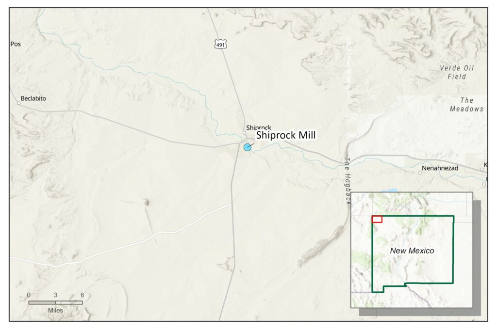
The former Shiprock mill site is located within the Navajo Nation in the northwest corner of New Mexico near the town of Shiprock, approximately 28 miles west of Farmington.
Ownership and History
The Shiprock site is a former uranium and vanadium ore processing facility located on the Navajo Nation. Known as the Navajo Mill at the time, Kerr-McGee built and operated the mill site from 1954 to 1963, after which Vanadium Corporation of America purchased the mill and operated it until its closure in 1968.
In 1983, the U.S. Department of Energy (DOE) and the Navajo Nation entered into an agreement for site cleanup. The DOE obtained a U.S. Nuclear Regulatory Commission (NRC) general license in 1996 for the Title I site under the Uranium Mill Tailings Radiation Control Act of 1987 (UMTRCA). UMTRCA Title I (regulated under Title 10 Code of Federal Regulations [CRF] Part 40, Appendix A) authorized remediating inactive uranium mill tailings sites prior to the law’s enactment in 1978.
By September 1986, all tailings and associated materials (including contaminated materials from offsite vicinity properties) were encapsulated in an NRC-approved disposal cell, which was built on top of the existing tailings piles.
The disposal cell and former mill site are located on a geological terrace (both natural and engineered) through which two minor drainages flow. The terrace groundwater system is assumed to be associated with past milling operations and irrigation. At the northeast edge of the terrace, a northwest-trending escarpment about 55 feet high forms the boundary between the terrace area and the San Juan River floodplain to the north, associated with a near-surface alluvial aquifer at the base of the escarpment. In 1961, Kerr-McGee drilled a test hole to a depth of 1,850 feet that resulted in artesian flow into the Bob Lee Wash that transects the northern area of the site. Discharge of almost 65 gallons per minute from the well continues today and supplies more than half the volume of groundwater in the floodplain. The floodplain aquifer also receives contributions from the San Juan River and the terrace groundwater system.
Currently, the water of the terrace groundwater system is approximately 24 feet below ground surface near the disposal cell and evaporation pond, but its depth varies widely across the site and changes with seasonality. The depth to groundwater in the floodplain area below is approximately 7 to 9 feet below ground surface. According to the DOE Office of Legacy Management (DOE-LM), past milling operations have left contaminants in both the terrace groundwater system and the floodplain alluvial aquifer. The DOE-LM reports that contaminated groundwater has reached the upper few feet of the underlying shale bedrock and contaminated the alluvial aquifer on the floodplain. The contaminants of concern are ammonia, manganese, nitrate, selenium, strontium, sulfate, and uranium.
Reclamation and Regulatory Jurisdiction
The state of New Mexico has no jurisdiction or regulatory role pertaining to the Shiprock mill and disposal site.
In 2002, DOE presented a draft groundwater compliance action plan, which presented a basis for selecting the compliance strategies outlined below. In 2005, DOE revised the conceptual model of the site to assess the groundwater treatment system design and provided recommendations on ways to improve the system. DOE currently implements three different compliance strategies at the site:
- Active remediation in the eastern portion of the terrace. Milling-related water from the groundwater system is pumped from extraction wells and collected in interceptor drains along Many Devils Wash and Bob Lee Wash. Removing this water through the well system and interceptor drains will dry the seeps and reduce the amount of groundwater reaching the surface. Extracted water is piped to an 11-acre evaporation pond on the south side of the disposal cell.
- Supplemental standards with monitoring in the western portion of the natural and engineered terrace. In the western portion of the terrace, groundwater is considered a limited-use resource (i.e., is not a current or potential source of drinking water) because it meets specific and defined criteria. In this area, it is considered limited use due to ambient contamination not related to milling activities that cannot be cleaned up using treatment methods reasonably employed in public water systems (40 CFR 192.11[e][2]). Some contaminants—selenium, sulfate, and uranium—may be naturally occurring due to the nearby Mancos Shale geological formation, and standards may never be achieved for this region.
- Natural flushing in conjunction with active remediation for the floodplain. The floodplain aquifer is undergoing active remediation involving the extraction of contaminated groundwater in conjunction with natural flushing, alternate concentration limits for selenium and sulfate, and continual monitoring. Alternate concentration limits may be adopted within specified areas if established maximum concentration limits are unattainable. Groundwater that infiltrates the floodplain from the eastern terrace system collects in interceptor trenches and wells located at the base of the escarpment. Around one million gallons of water is extracted from the floodplain contaminant plume each month and is piped to the evaporation pond on the terrace.
DOE chose the different compliance strategies based on the amounts of contamination in each area, and a different balance of groundwater recharge. Groundwater monitoring and surface water monitoring are occurring at all three areas. The NRC reviews all DOE-LM plans and actions. In addition to the three compliance strategies listed above, institutional controls on the floodplain are in place to minimize the potential risk to human health and the environment, including (1) grazing restrictions, (2) control of access to the floodplain area, (3) a DOE–Navajo Nation agreement prohibiting groundwater use in the floodplain, and (4) assurance from the Navajo Nation Water Code Administration that the flowing artesian well can continue to flow into Bob Lee Wash and onto the floodplain.
Timeline for Completion of Cleanup Activities
The DOE-LM conducts annual inspections of the site, performs site maintenance as necessary, and monitors groundwater in perpetuity to ensure the continued integrity of the disposal cell.
In accordance with the standards outlined by EPA in Title 40 CFR Part 192.02(a), the disposal cell is designed to be effective for 1,000 years, to the extent reasonably achievable, and for at least 200 years in any case. The general license has no expiration date, and DOE-LM’s responsibility for the disposal cell will last indefinitely.
Because the site is located on the Navajo Nation, the state of New Mexico cannot weigh in on a completion timeline or progression of cleanup.
Coordination Between State and Federal Agencies
The site is under long-term stewardship by DOE-LM on the Navajo Nation and regulated by the NRC. There is no coordination with the State of New Mexico.
Anticipated Funding Requirements
While there is no available site-specific funding requirement for the Shiprock site, DOE-LM periodically provides a rounded ‘75-Year Constant Dollar Total’ cost for all UMTRCA Title I Sites to the U.S. Congress. As of 2022, the combined total of $709,073,000 was estimated for all Title I sites.
Disclaimer
Site reviews in this report provide the reader with a general history and status of permitted mines and mills. For brevity, they may not provide all relevant details or agency actions related to each site. All information regarding the Shiprock site is sourced from information publicly available on the DOE-LM website.